TEGAKARI
  • Home
  • Overseas Products What's New (Unipos)
  • R & D PC configuration example (Tegsys)
  • Service information for R & D
    • Rental service tegakari
  • Technical information articles
  • Version upgrade information
  • News from TEGARA
  • Contact Us
Pickup new articles
  • [April 2025, 7] PLA 3.0 compatible machines Research workstation
  • [April 2025, 7] Reasons for choosing the TKS Division | A system that can be used immediately after delivery Overseas Products What's New (Unipos)
  • [April 2025, 7] Workstation for Electromagnetic Field Analysis Research workstation
  • [April 2025, 7] Machine for large-scale language model calculation Research workstation
  • [April 2025, 7] MAGMA dedicated machine for large-scale numerical calculations Research workstation

Home > Version upgrade information > [Release Information] Global Mapper v25 | Multifunctional GIS data processing application

[Release Information] Global Mapper v25 | Multifunctional GIS data processing application

2023/10/16 TEGARA Co., Ltd. Mathematical Science, engineering, Biology / Agriculture, Informatics, Automotive / vehicle related, Business support and efficiency tools, Overseas Products What's New (Unipos), Version upgrade information

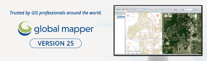
Blue Marble Geographics' GIS data processing application "Global Mapper” version 25 has been officially released (September 2023).

It is a popular product as general-purpose GIS software that visualizes and analyzes geospatial information, and is an application used all over the world.

table of contents

  • About Global Mapper
    • Major features
  • About the new version 25 of Global Mapper
    • Global Mapper Standard
    • Global Mapper Pro
    • Reference information
  • About license and version upgrade
    • About license transfer
  • Demo version of Global Mapper
  • Main research and development fields
  • Related research and development themes


About Global Mapper

Easy-to-use software for both map and spatial data professionals and general map users.It supports a variety of data formats and can efficiently perform data conversion, terrain analysis, 3D display, etc.

Intuitive operability allows everyone to work smoothly.It is used in a wide range of fields such as education, transportation, and public institutions, and exhibits high GIS data processing ability and map creation capabilities.Due to its easy operation and high performance, it has a reputation as an important tool for using maps and GIS data.

Major features

  • Compatible with over 300 data formats for efficient data conversion
  • Has LiDAR point cloud data processing, analysis, and editing functions
  • Terrain analysis such as terrain analysis and contour creation (analysis and evaluation of terrain characteristics)
  • 3D terrain models can be generated from orthoimages and DEMs
  • Fast display and editing of a wide range of spatial data


About the new version 25 of Global Mapper

Top New Features in Global Mapper Pro v25

In the new version 25 of Global Mapper, both the Standard and Pro editions have significantly enhanced 3D display functions and various data analysis tools, as well as many general-purpose functions such as operability and processing speed.

Global Mapper Standard

  • Ability to search for the best location for site leveling
  • Ability to use 3D vector data to simulate potential flow obstructions/channel modifications in watershed generation
  • Ability to apply unique automatic styles to unknown vector data types for better visibility between layers
  • Improved display performance on high resolution displays
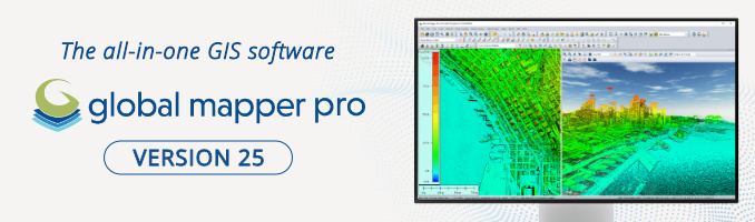
 

Global Mapper Pro

  • Added least-cost path analysis tool to determine optimal path over terrain
  • Updated pixel to point conversion wizard to simplify setup
  • Improved denoising and surface detection based on lidar data segmentation
  • Raster painting tools allow manual editing of RGB and palette images
  • Grid DEM data can now be adjusted perpendicular to 3D control points to improve the accuracy of elevation QC analysis tools
  • Improved tree footprint generation function that can be used for forest surveys and biomass estimation.
  • Added a function that allows mutual verification of kriging results (predicted surface data) and control data.

Warnings

Global Mapper Pro integrates the functionality of traditional LiDAR modules, allowing you to process and analyze LiDAR data.Basic GIS data processing, editing, and conversion can be done with Global Mapper, but if you need more specialized functions, you will need to use Global Mapper Pro.
Please note that Global Mapper Pro is an add-on product that provides additional functionality to Global Mapper Standard. When you purchase Pro, you will receive two licenses: a Standard license and a Pro license, and by installing both you will be able to use the Pro features.


Reference information

In addition, many functional improvements have been made.Please refer to the manufacturer's website below.

Top New Features in Global Mapper Standard v25.0
https://www.bluemarblegeo.com/top-new-features-in-global-mapper-standard-v25-0/
Top New Features in Global Mapper Pro v25
https://www.bluemarblegeo.com/top-new-features-in-global-mapper-pro-v25/
Welcome to Global Mapper
https://www.bluemarblegeo.com/knowledgebase/global-mapper-25/GlobalMapper.htm


About license and version upgrade

Global Mapper is a perpetual license. Blue Marble Geographics' maintenance and support includes access to major version updates and technical support within one year of purchase.Annual renewals are required for continued support.If you would like maintenance, please contact us.

We also handle upgrade licenses from previous versions to v25.xx.If you would like to upgrade, pleasePlease let us know your current license information.

*If the maintenance deadline is after September 2023, 9, you will be eligible for a free upgrade.

For details on the license, please seeLicense Terms (Manufacturer Page)Please Confirm.


About license transfer

If you need to transfer your license, such as when replacing your PC, you will need to uninstall the software from your existing PC.
With the release of Version 25, older versions (version 23 and earlier) are no longer available from the manufacturer's download page.Therefore, before installing an older version of the software on a new PC, make sure you have the Global Mapper installation files.


Demo version of Global Mapper

Global Mapper is free to use for 14 days.
Please download the trial version from the manufacturer page.

Download a free trial
https://www.bluemarblegeo.com/global-mapper-download/

*For details on system requirements,Manufacturer web page.


Main research and development fields

GIS – Geographic information system / Cartography – Cartography / Aerial photography – Photogrammetry / Data conversion – Information engineering / Remote sensing / DEM – Civil engineering / Simulation – Disaster prevention engineering / Hydrology / Meteorology / Geology / Urban engineering / Traffic engineering / Forest science / Agriculture / Oceanography / Architecture / Design / VR/AR / Orthoimage – Photogrammetry

Related research and development themes

Topographic survey / Map creation / Flood and volcanic eruption simulation / Urban and transportation infrastructure planning / Forest resource survey / Aerial photography / remote sensing / Geological survey / Climate change impact assessment / Natural disaster risk assessment / Environmental impact assessment / Survey using drones / Simulation using VR/AR / Research and development of wooden houses and wood materials / Next-generation construction production system 

■ Click here for product details and inquiries
Global Mapper / Global Mapper Pro | GIS Data Processing Application
Manufacturer (Blue Marble Geographics) WEB site

  • Photogrammetry
  • GIS
  • Surveying
  • ArcGIS
  • TO DEAL
  • Infrastructure
  • Geology
  • Map

People who read this article also read this article

Robotics

ROS compatible 2D distance sensor "360 Laser Distance Sensor LDS-01" has been added.

2018/5/14 TEGARA Co., Ltd. Robotics, Overseas Products What's New (Unipos)

■This article was posted on May 2018, 5, so the information may be out of date.ROS compatible 14D distance sensor 2 Lase on Unipos website […see next] […see next]

Version upgrade information

The latest version 23 of the GIS data processing application "Global Mapper" has been officially released.

2021/10/15 TEGARA Co., Ltd. Informatics, Overseas Products What's New (Unipos), Version upgrade information

■This article was posted on October 2021, 10, so the information may be out of date. Blue Marble Geographics' GIS data processing app […see next] […see next]

R & D PC configuration example (Tegsys)

Machine for software such as Agisoft PhotoScan, Pix4d

2017/1/23 TEGARA Co., Ltd. Multimedia (video / image / audio) processing, Overseas Products What's New (Unipos), R & D PC configuration example (Tegsys)

■ This is an article posted on January 2017, 1, so the content of the information may be out of date.Agisoft PhotoScan, which is processing software for aerial photographs, […see next]

Site search:

Tegara YouTube Video

[Effect of IR Pass Filter] Shoot whiteboard with RealSense D435 and D435f

The latest posted video is displayed.
Other videosTegara Corporation Youtube channelplease look at

Popular Articles (Access ranking for the last 7 days)

  • furix BetterWMF and CompareDWG tools for AutoCAD [Product introduction] Beyond Compare: File and folder comparison, integration and synchronization utility 2022/11/18
  • Burp Suite Feature Comparison (Enterprise Edition vs. Professional) 2024/8/9
  • [Product introduction] MarineTraffic: real-time information provision service on ships (subscription plan) 2023/4/6
  • [Product introduction] Leap Motion Controller 2 – Hand tracking camera that recognizes hand and finger movements 2023/6/9
  • The latest version 10 of the refrigerant thermophysical property database REFPROP has been released 2018/6/6

Latest posts

  • PLA 3.0 compatible machines
    2025/7/18
  • Turnkey systems accelerate the initial research phase! Tegara's TKS Division
    Reasons for choosing the TKS Division | A system that can be used immediately after delivery
    2025/7/14
  • Workstation for Electromagnetic Field Analysis
    2025/7/11
  • Machine for large-scale language model calculation
    2025/7/9
  • MAGMA dedicated machine for large-scale numerical calculations
    2025/7/8

Featured tags

Analysis tool (56) 3D camera (55) Machine learning (machine learning) (53) AI (47) Robotics (45) VR (44) Robot arm (42) Bioinformatics (42) RealSense (41) Statistical analysis (39) Deepearning (37) Video / Video (37) SBC (36) Depth camera (36) instrumentation (35) Small SBC (35) IoT (35) Spectrum (33) simulation (33) Data analysis (31) First principle (29) Python (29) Cyber ​​security (28) Next-generation sequencer (27) JavaScript (27) AR (27) Chemical (27) . NET (26) In-vehicle (25) Image processing (25) Image analysis / image inspection (25) TO DEAL (25) Metashape (25) MATLAB (24) UI (24) Photogrammetry (23) Educational robot (22) 3D model (22) prototype (22) Support (22) Molecular biology (22) Web development / production (21) Measuring instrument (21) Test tool (20) material (20) GIS (20) Psychology (19) Visualization (19) Animation (19) ROS (19) Electromagnetic field analysis (19) Mech robot (19) Mobile robot (19) Drone (19) Robot hand (19) security (19) programming (18) EEG (18) ToF (18) Autonomous vehicle (18) protocol (18) gene (18) Raspberry Pi (17) CAE (17) Deep learning (17) Clinical (17) 3D printer (17) DNA (17) tracking (17) Bioassay (17) Motion capture (17) Education (16) chart (16) Industrial (16) XNUM XD modeling (16) Structural analysis (16) modeling (16) Molecular dynamics (15) biostatistics (15) Fluid analysis (15) drug development (15) Arduino (15) AR / VR (15) 3D scan (15) Library (15) Movie editing (15) RNA (15) Malware (14) CFD (14) Articles delivered in August 2022 (14) CUDA (14) 写真 (14) Information dissemination September issue (14) others (14) Articles delivered in August 2022 (14) Device control (14) Agriculture / Agriculture (14) SLAM (14) Stimulus presentation (14) Voice processing (13) Depth sensor (13) Surveying (13) Nanostructured material (13) Numerical analysis (13) Monitoring (13) Development and evaluation kit (13) STEM / STEAM education (13) IDE (Integrated Development Environment) (13) 24 hours operation (13) 3D CAD (13) Thermal fluid analysis (13) Genome analysis (13) wireless (13) control (13) Looking Glass (12) GPGPU (12) natural Science (12) Quantum chemistry calculation (12) CAD (12) FDTD method (12) Capture glove (12) Deep Lab Cut (12) Remote operation (remote control) (12) Information dissemination February 22 issue (12) Information dissemination February 22 issue (12)
Find Information by Field-Category
  •  Humanities / Social Sciences
  •  Mathematical Science
  •  Chemical
  •  engineering
  •  Medicine / Nursing / Pharmacy
  •  Biology / Agriculture
  •  Informatics
 
  •  Artificial intelligence
  •  Robotics
  •  Sensor technology
  •  Development kit / electronic work
  •  Digital gadget
  •  Automotive / vehicle related
  •  Industrial communication technology
  •  Application development and programming
  •  Network security
  •  Multimedia (video / image / audio) processing
  •  Business support and efficiency tools
Translate
Contact Form – Contact
Click here to contact TEGAKARI
Site link
Privacy Policy
Management website (service)
TEGARA Co., Ltd.
TEGARA CORPORATION corporate site

UNIPOS
Overseas product procurement and consultation services for R & D

Tegusis
Research and industrial PC production and sales services
SNS account
  • Twitter
  • YouTube
  • Facebook

TEGARA Co., Ltd.

Tegara is a platform that provides R & D with useful products, services, and information in an integrated manner. "Helping accelerate R & D"

Copyright © 2020 | Tegara Corporation